Around Brown Willy
30.05.2025
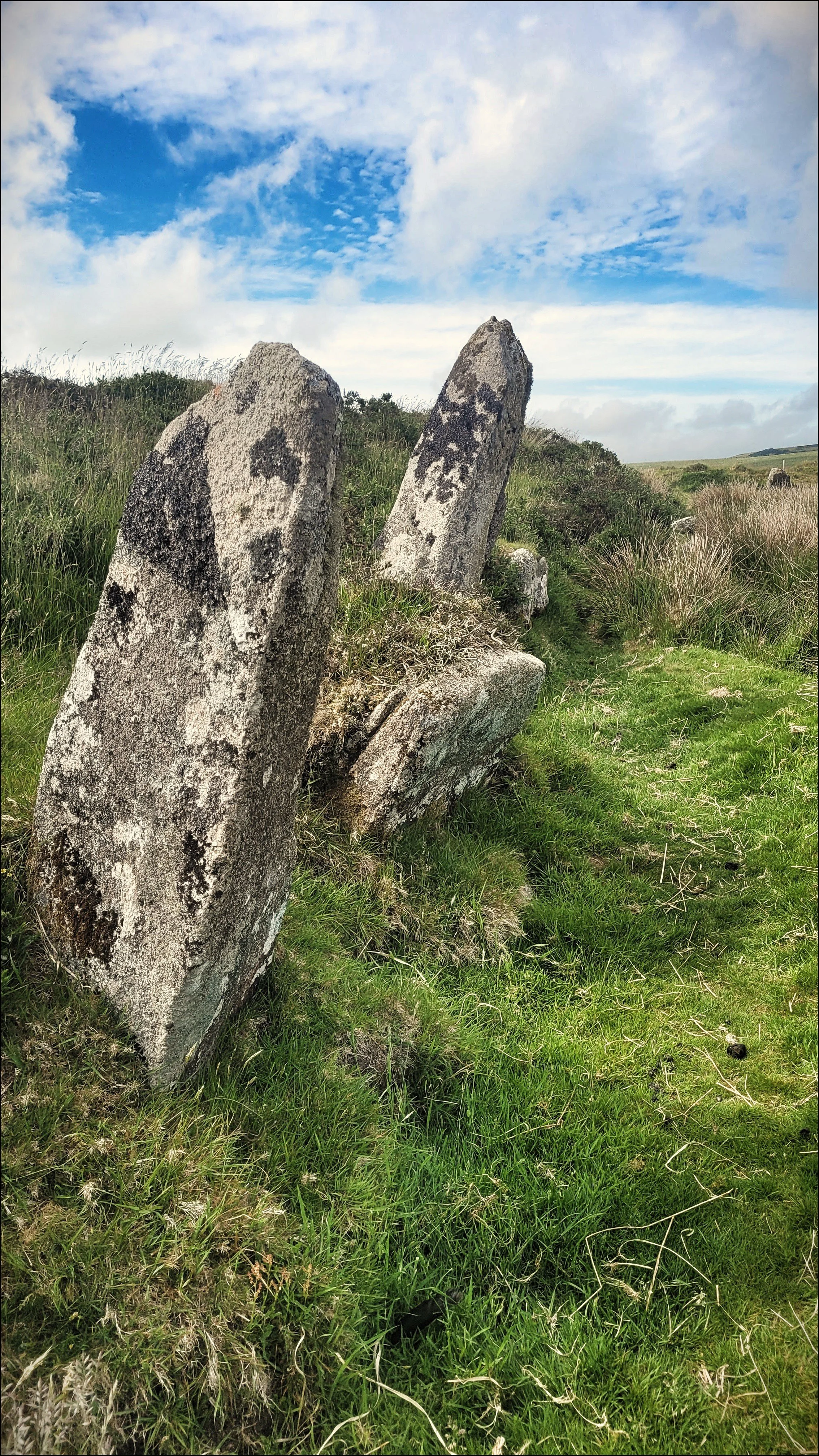
North East of Brown Willy, the highest peak in the south west are a collection of ancient sites that are possible to see on a circular walk from Jamaica Inn. I headed under the A30 as I’d done the day before and found a path through pastures up to Tolborough Tor and over the other side to Catshole Down. I came across a barrow here in a pretty ruinous state with only one small upright. It wasn’t marked on OS but was listed as Catshole Downs Long Cairn on Megalithic Portal. I could see a track up ahead that would take me around the north eastern side of Brown Willy for a good hour and on to Rough Tor, my first destination.
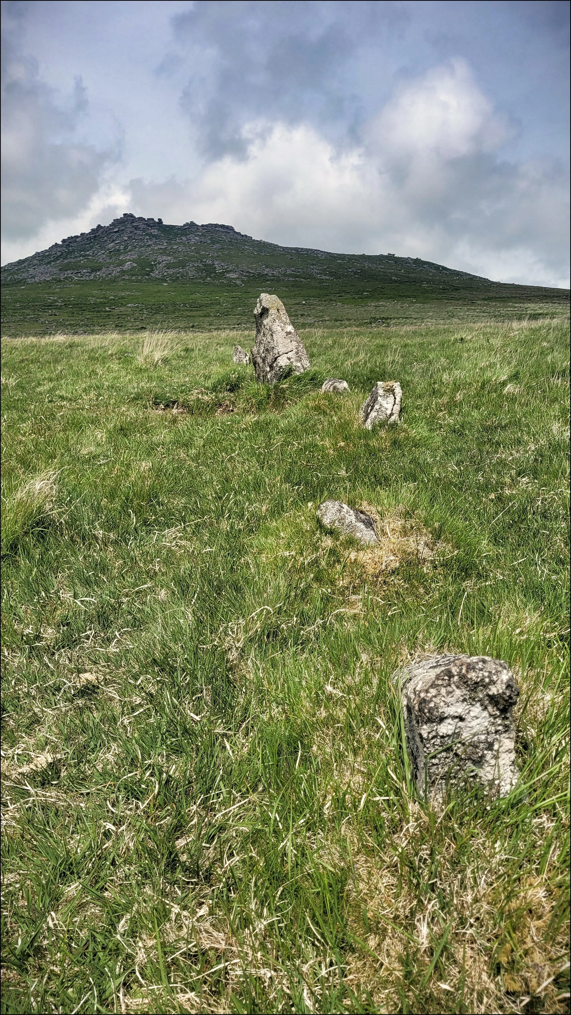
Rough Tor came into view as the path arced left through grazing cattle to Maiden Tor where I rested, took on water and scanned the high crags that made up the long saddle back ridge of Rough Tor and Little Rough Tor. It was as dramatic looking as Brown Willy and had the added feature of a Neolithic settlement on it’s eastern slopes. The walled field boundaries were clearly visible and the remains of hut circles were scattered around the slopes. Somewhere up on the top between the Tors was a long cairn. I carefully picked my way through the thick ground cover that disguised the awkward uneven ground of the deep hoof prints of cattle. At the bottom of the valley I climbed over a stock fence and jumped a stream, then walked up the eastern slope past the old enclosure walls to the ridge between the Tors. The view to the north was timeless. I sat and looked out at the scattered stone and imagined what the settlements would have looked like from Little Rough Tor.
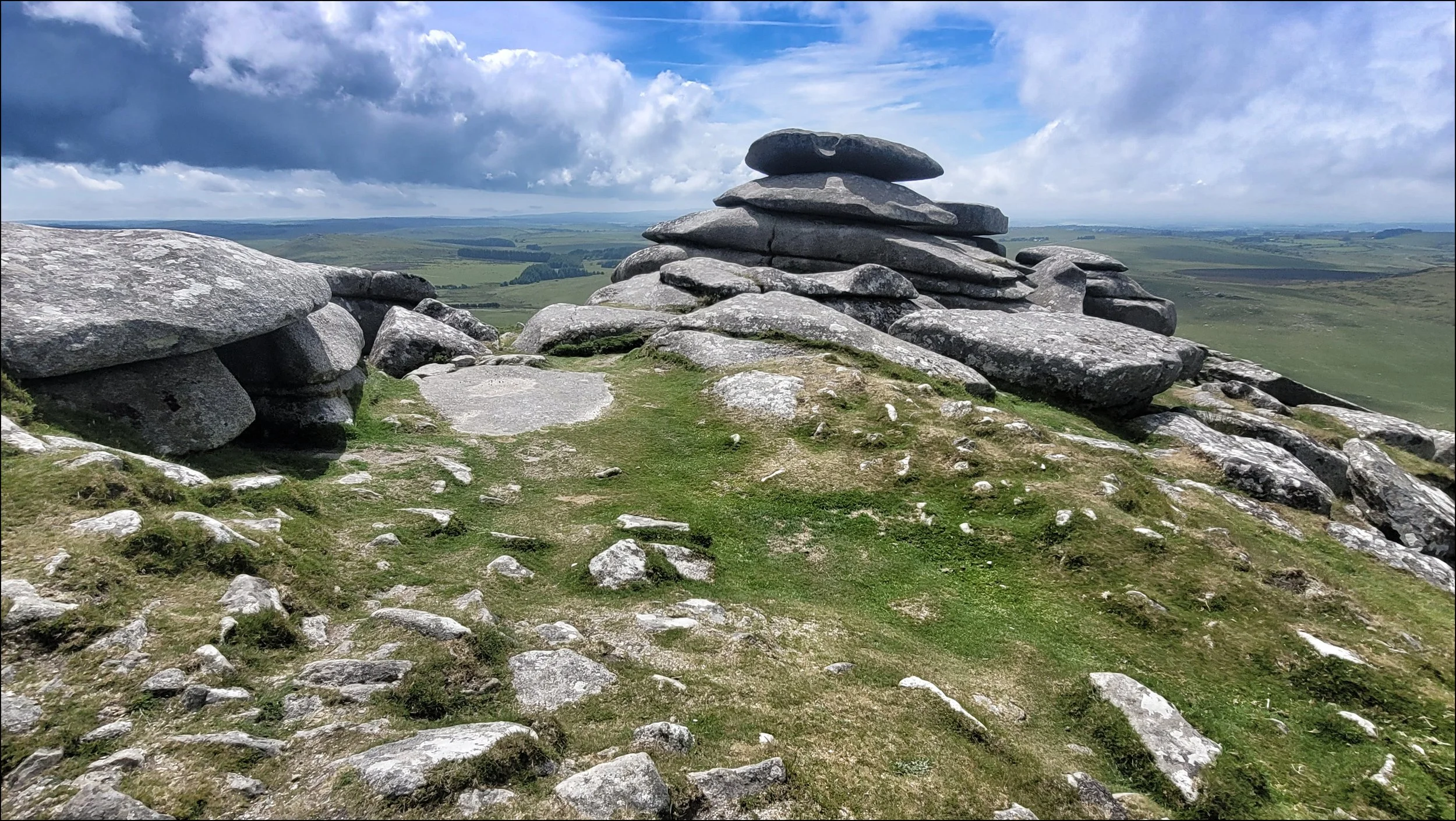
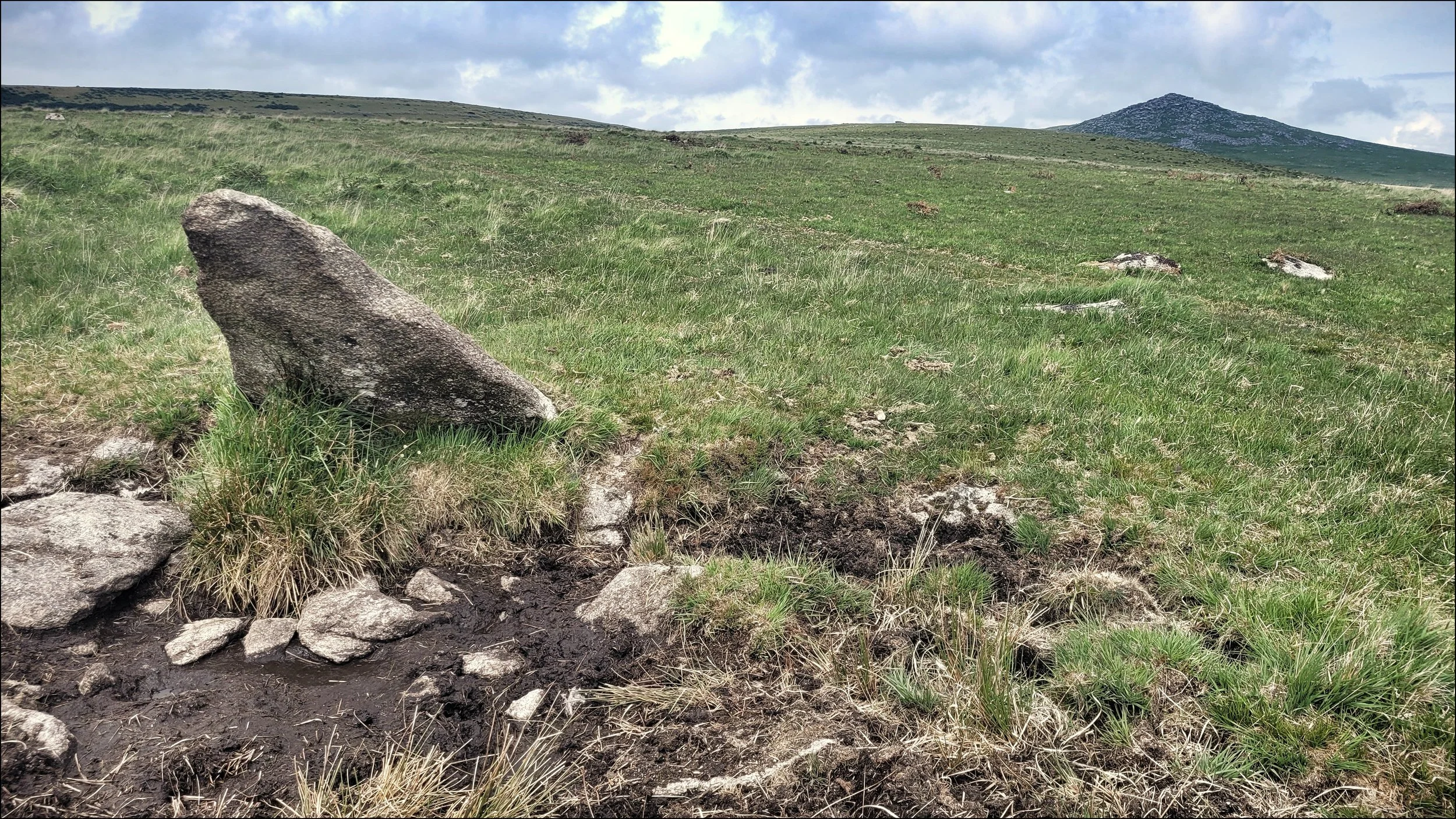
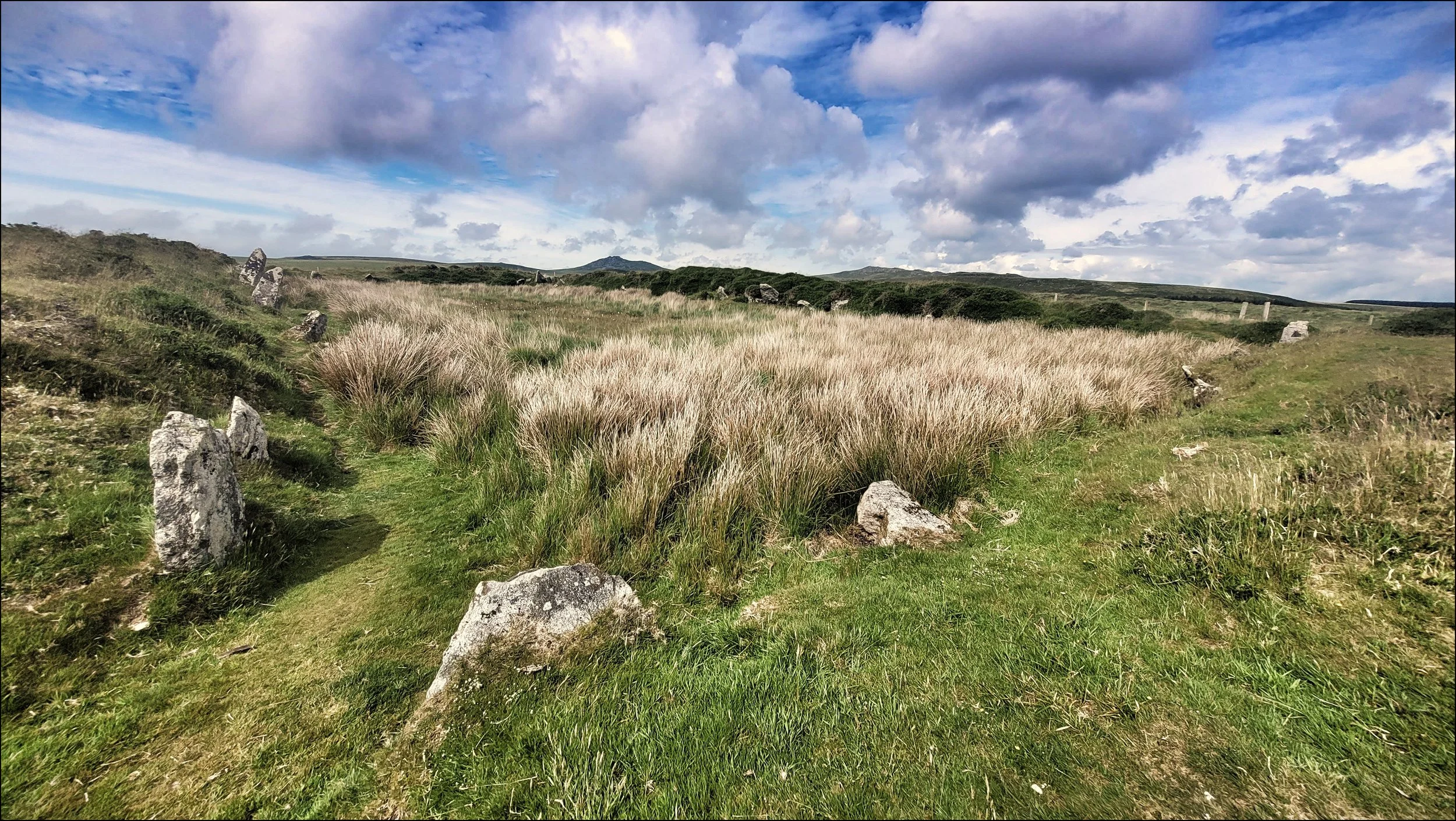
I walked south along the ridge past the pancake formations and came to the long cairn. Amongst the natural rock formation it was possible to make out man made curbstones, slabs of pavement and smoothly fashioned recesses in the outcrops. The view south was equally rewarding. Down on the plateau before me due south was the distant stone circle of Fernacre. It came into view as I made my tricky descent zig zagging the large strewn settlement stone on Rough Tor’s southern slope. There were cairns at the base too as I made my way over to Fernacre. The circle was large at a hundred and forty four feet across, similar to the central circle at the Hurlers, but here there were thirty nine stones from an original seventy, all no higher than three feet. At one time they would have been taller but over the years they had gradually sunk into the peat. I walked around it’s perimeter to the Tri stone on the eastern edge. There were skylarks nesting here so I was careful with my footing. After two circuits I concluded there was something missing from this circle. The energies between these granite stones felt negligible. I stood at it’s centre and waited a while for the surrounding moor to emerge from under the shadow of a cloud. The sunlit grass drew close on occasions but fizzled out before it reached me. The skylarks were noisily protesting at my presence so I left Fernacre behind to head west to find Louden and Stannon circles.
I arrived at Louden Circle after a twenty minute hike due west. I sat on top of a rise just off the track and noticed the circle was similar in size to Fernacre but with less stones still standing. Here the well preserved Tri stone was positioned to the south and leaning out with four other visible stones near to it. The Timeseekers Volunteers had attempted a restoration but the boggy marshland had swallowed a great many of the missing stones.
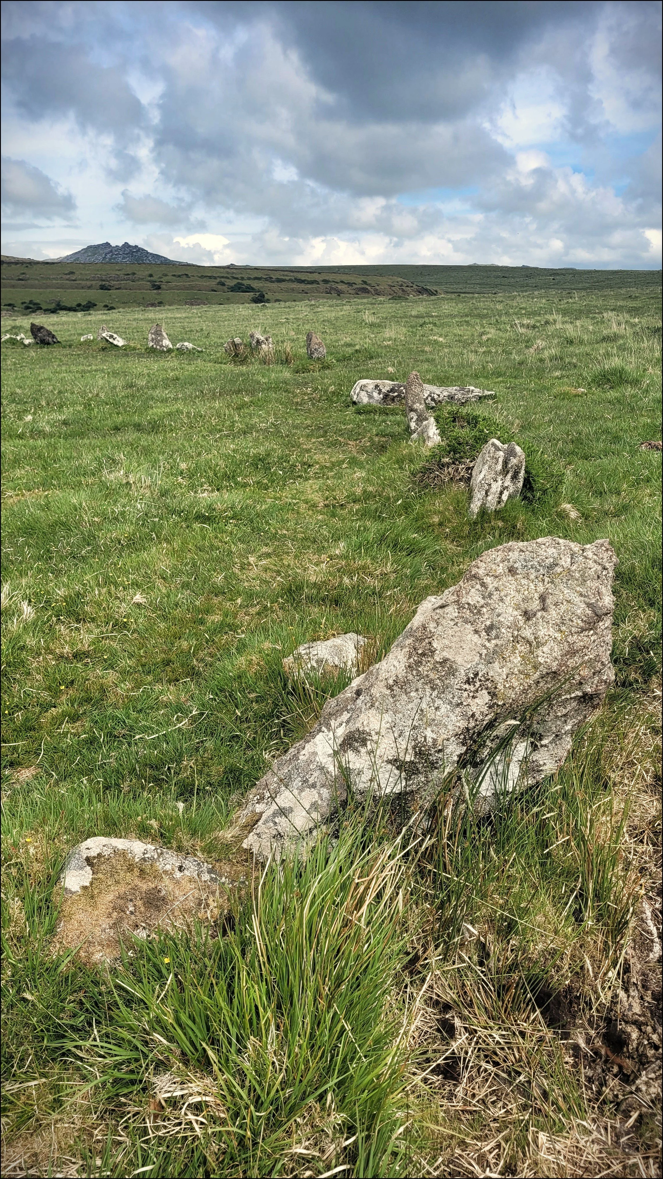
I crossed the track and aimed in the direction of north west to find Stannon Circle. There was no path at first but the ground was firm. The circle was low lying and so not visible until I was close to it. Again the stones were within a one hundred and forty feet diameter, but here they were tightly packed together and more satisfying to view as a whole. Here the Tri Stone was the biggest stone and positioned at the western edge, prompting the now obvious question of how these three circles may have been linked up geographically. I felt very different at this circle and was aware of a charge emanating from it. I stood on a flat outlying stone behind the Tri stone that was leaning out in it’s own ditch of water. My eyes were drawn to Rough Tor in the distance and the notch like gap between the Tors on it’s summit. I began to feel it might be a significant sight line in some way. As I waited for the sun to emerge a farmer and his Collie passed by in a Landrover, giving me a quizical glance at my statue like state. The sun shone briefly over me and the stones and triggered the feeling of a memory in me I did not know.

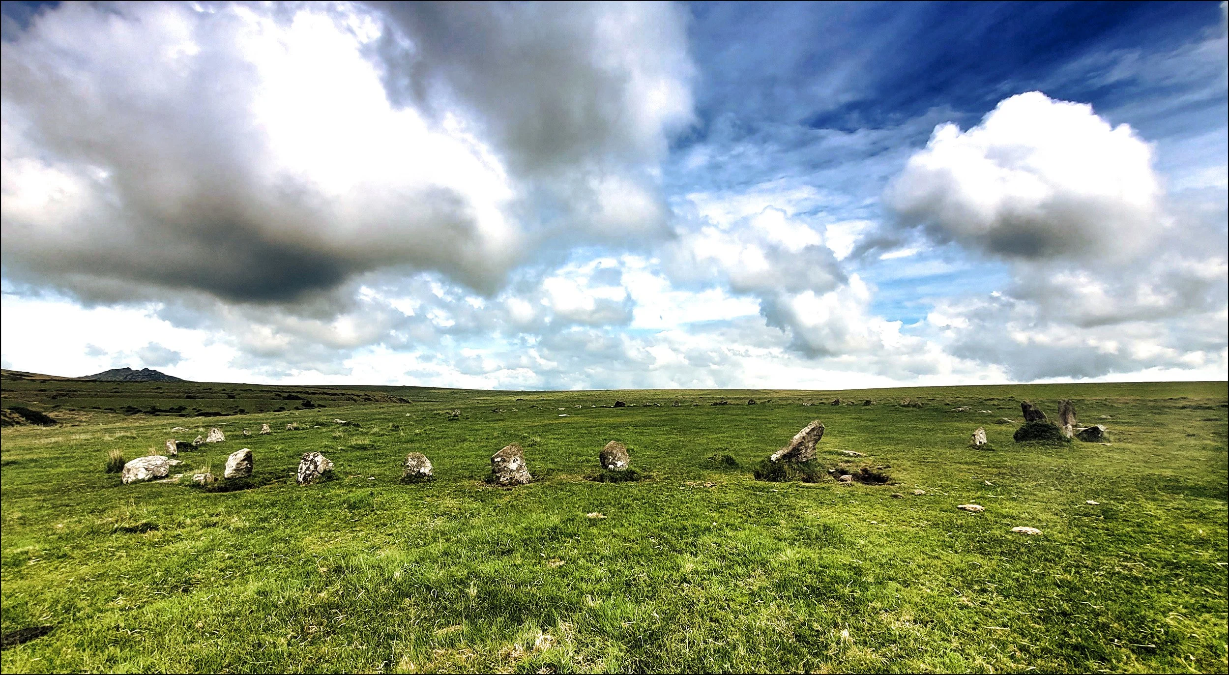
I felt I had made a new friend, much like when I have viewed a painting I particularly like in a gallery somewhere. I was beginning my return journey across marshy ground of hidden water amongst tall grasses. My next site was King Arthur’s Hall directly ahead but the shortest route to it was through bog land and soon my feet were wet from what felt like a giant sponge beneath me. I wasn’t sure what I would find ahead and when I eventually got up onto high dry ground I found a rectangular fenced off compound with a gateway on the south side. I entered the compound and was astonished to find a banked oblong shaped space lined with fifty six thin but tall standing stones. The Stones were placed side by side and faced inward, suggesting the space might have been a meeting place for elders or even a king. Or was it a place of entertainment maybe ? I had never seen anything quite like it. Standing on the southern bank the paved spaced now looked overgrown and the stones around it looked like high backed chairs. Had the Hall at one time been covered with a timber roof and how far away had people come to meet here I wondered. This area around Brown Willy may have been an important centre on the Cornish peninsular.
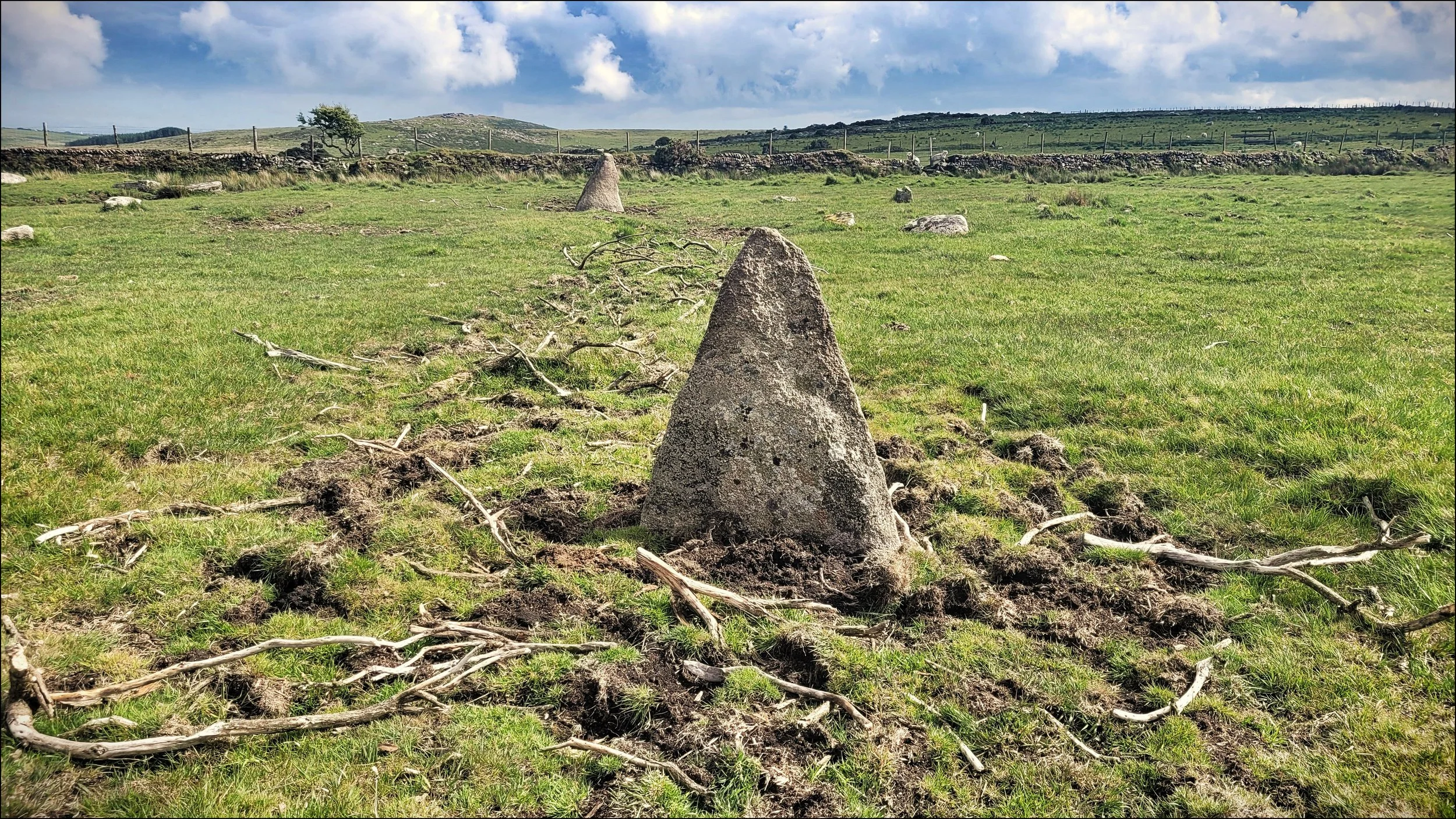
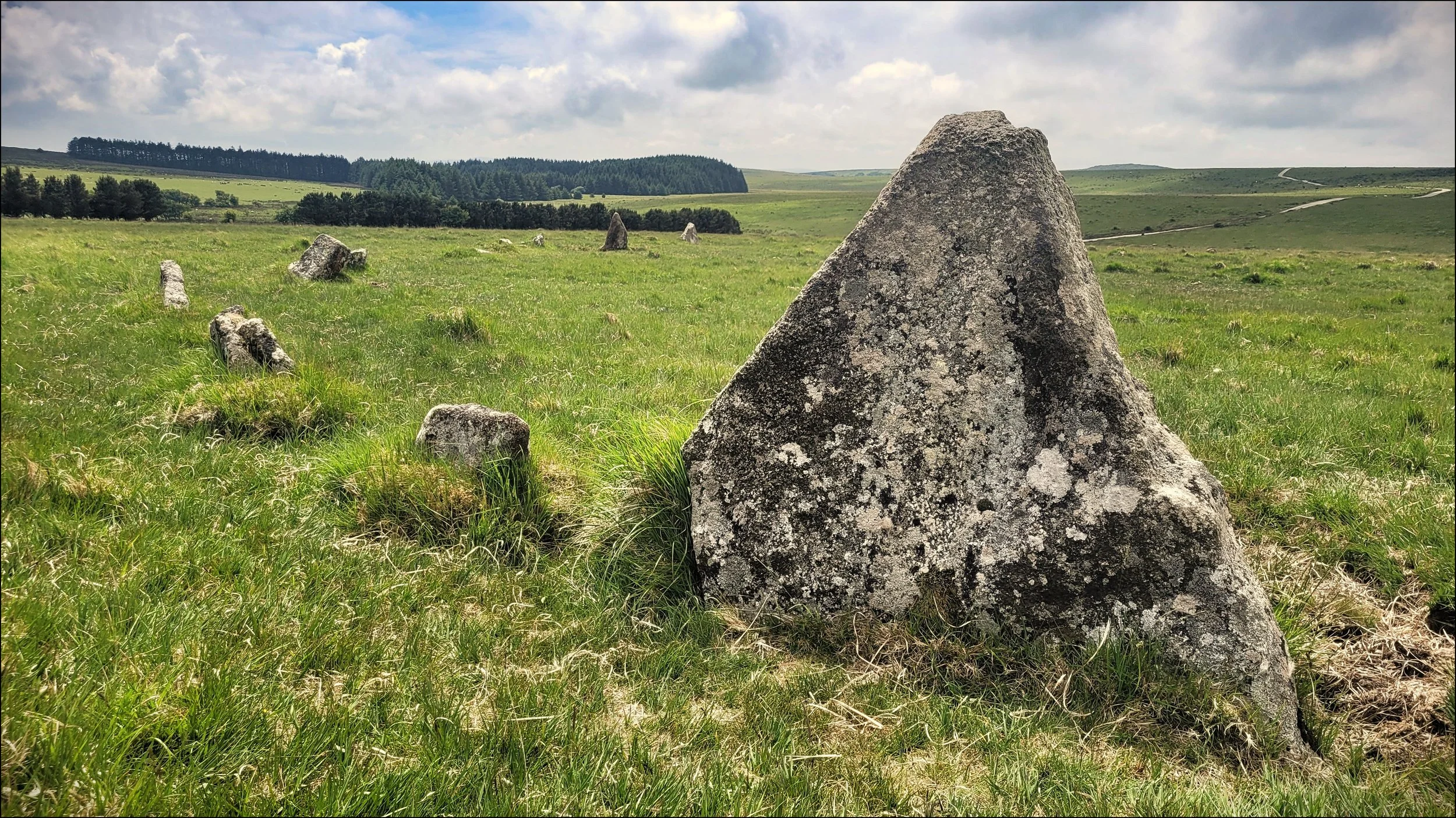
Five hundred yards to the east off an indistinct path was one of two circles named King Arthur’s Downs. Only twenty five meters in diameter and with only six standing of a remaining eight, two of these stones were large and triangular and were facing each other. Between them and quite mysteriously placed were a collection of branches with their bark stripped off. It looked like a poor attempt at land art or debris from a pagan ceremony. Remains of another circle could be seen near a drystone wall but it was hard to make sense of as most of the stones had been removed and may well have ended up in the wall.
I had been walking for nearly six hours and I was still a good hour away from Jamaica Inn. The remainder of the route back was difficult and at times I felt no one had ever before walked the boggy river banks and dark woodland in this testing part of Bodmin Moor.